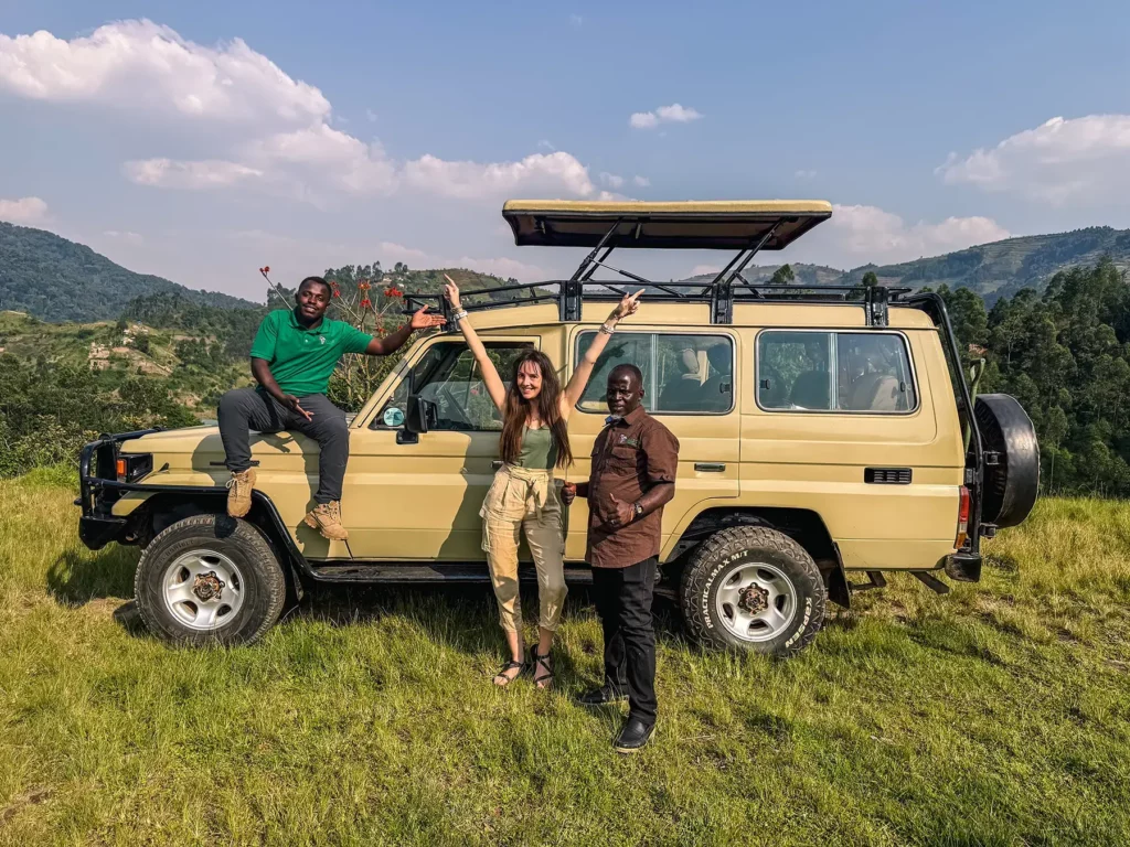
Plan a two-week Uganda road trip with daily routes, drive times, fuel stops, road conditions and unforgettable stops from Kampala to Bwindi and beyond.
Two-week Uganda road trip itinerary
A two-week Uganda road trip can take you from the source of the Nile to the savannah of Murchison Falls, the crater lakes around Fort Portal, the forests of Bwindi and the open plains of Lake Mburo. It is the kind of journey where the road itself becomes part of the holiday: red soil on the tyres, roadside markets flashing past the window and a sudden herd of cows bringing traffic to a gentle pause.
This Uganda road trip itinerary is designed for a self-drive traveller starting and finishing in Kampala. It covers roughly 2,000 kilometres, depending on the chosen park gates and accommodation locations. The route is ambitious, so the best experience comes from starting early, avoiding night driving and allowing extra time for traffic, rain and roadworks.
Uganda road trip route at a glance
| Days | Route | Approximate distance | Suggested overnight |
| 1 | Kampala to Jinja | 80 km | Jinja |
| 2 | Jinja and the Nile | Local driving | Jinja |
| 3 | Jinja to Sipi Falls | 190–210 km | Kapchorwa/Sipi |
| 4 | Sipi Falls to Kampala | 300–330 km | Kampala |
| 5 | Kampala to Murchison Falls | About 305 km | Paraa or nearby |
| 6 | Murchison Falls National Park | Local game-drive routes | Paraa |
| 7 | Murchison to Fort Portal | About 371 km | Fort Portal |
| 8 | Fort Portal and Kibale | About 26 km to Kanyanchu | Fort Portal/Kibale |
| 9 | Fort Portal to Queen Elizabeth | About 117 km | Mweya or nearby |
| 10 | Queen Elizabeth National Park | Local park routes | Mweya |
| 11 | Queen Elizabeth to Bwindi | About 160–250 km | Bwindi sector |
| 12 | Bwindi | Local access roads | Bwindi |
| 13 | Bwindi to Lake Mburo | About 225–275 km | Lake Mburo |
| 14 | Lake Mburo to Kampala | About 240 km | Trip ends in Kampala |
Distances are estimates. Uganda’s national parks have multiple gates and sectors, and your final figures will change according to the lodge, campsite and route you choose. For example, travel between Murchison Falls and Fort Portal is commonly estimated at about 371 km and seven to eight hours, while Kampala to Lake Mburo is roughly 230–255 km.automag+1
Days 1–2: Kampala to Jinja
Route
Kampala → Mukono → Lugazi → Mabira Forest → Jinja
Distance and drive time
Allow around 80 km and approximately two hours in normal conditions, although Kampala and Mukono traffic can make the journey much longer.
Leave Kampala early. The road through Mukono and Lugazi is busy, with trucks, taxis, boda bodas and pedestrians sharing the highway. The tarmac is generally good, but patience matters more than speed.
Mabira Forest is a natural place to break the journey. You can stretch your legs, take a guided walk or simply enjoy the change from traffic and buildings to thick green forest.
Continue to Jinja and spend the afternoon exploring the riverside town. Depending on your interests, choose a boat trip, a visit to the Source of the Nile or a relaxed walk around the old town.
Fuel stop
Fill up in Kampala or Mukono before leaving. Jinja has many fuel stations, so it is also a good place to refuel before heading towards eastern Uganda.
Where to stay
Stay in Jinja for two nights. This avoids rushing the first day and gives you time to enjoy the Nile rather than treating Jinja as a quick photo stop.
Day 3: Jinja to Sipi Falls
Route
Jinja → Iganga → Mbale → Sironko → Kapchorwa → Sipi Falls
Distance and drive time
Plan for approximately 190–210 km and four to five hours, excluding sightseeing and stops. [VERIFY: Confirm the exact route distance with your accommodation because Sipi-area access roads vary by lodge location.]
The road towards Mbale is mostly paved, but traffic, trading centres and slow-moving vehicles can affect the timing. After Mbale, the climb towards Kapchorwa becomes more dramatic. The landscape opens into farms, valleys and distant hills, with cooler air replacing the heat of the lowlands.
Sipi Falls is a good place to slow down. You can hike between the waterfalls, visit coffee farms or sit outside in the evening while the escarpment disappears into mist.
Fuel stop
Fuel in Jinja and top up again in Mbale. Do not assume that every small trading centre near Sipi will have a reliable fuel supply.
Road conditions
The main highway is paved, but the final approach to some Sipi lodges may be steep, narrow or uneven. A two-wheel-drive car can manage many routes in dry weather, but check the access road before travelling, especially during heavy rain.
Day 4: Sipi Falls to Kampala
Route
Sipi Falls → Kapchorwa → Mbale → Iganga → Jinja → Kampala
Distance and drive time
Allow most of the day. The journey back to Kampala is roughly 300–330 km, depending on your exact starting point and route.
This is the least exciting driving day, but it gives the itinerary breathing space before the longer western and northern sections. Leave early, take regular breaks and avoid arriving in Kampala after dark if possible.
If you prefer a slower trip, you can stay in Jinja on Day 4 and return to Kampala early on Day 5. That makes the itinerary more comfortable, but it reduces the time available in Murchison Falls.
Days 5–6: Kampala to Murchison Falls
Route
Kampala → Luweero → Nakasongola → Kafu River area → Masindi → Murchison Falls National Park
Distance and drive time
From Kampala to Murchison Falls is approximately 305 km. Allow five to seven hours, depending on traffic, stops and the park gate you use.
The road through Luweero and Nakasongola is largely paved. After Masindi, the approach to the park and internal roads become more demanding. Park roads are generally dirt or gravel; they can be dusty in dry weather and slippery or deeply rutted after rain.
Enter through the gate that matches your accommodation. The north bank and Paraa area are common choices, but crossing the Nile and reaching a particular lodge can add time.
Fuel stops
- Fill up fully in Kampala.
- Top up in Nakasongola if necessary.
- Masindi is the key refuelling and shopping point before entering the park.
Carry drinking water and basic snacks. Once inside the park, options are more limited and prices may be higher.
Day 5 activities
Treat the drive as the main activity. Arriving safely matters more than forcing in a late game drive.
After checking in, visit the top of the falls if time allows. The Nile squeezes through a narrow gorge before dropping into the river below, creating one of Uganda’s most dramatic natural viewpoints.
Day 6 activities
Start with an early game drive on the savannah. The morning is cooler and gives you a better chance of seeing wildlife before the day becomes hot.
Later, take a boat cruise towards the base of Murchison Falls if your schedule and operator arrangements allow. The riverbanks offer a different perspective from the game-drive tracks, with hippos, crocodiles, birds and other wildlife often visible near the water.
Day 7: Murchison Falls to Fort Portal
Route
Murchison Falls → Hoima → Kibaale town area → Fort Portal
Distance and drive time
This is one of the longest days: approximately 371 km and seven to eight hours of driving.
Leave before breakfast if possible. The road via Hoima offers changing scenery, from the park’s open country to greener western landscapes. Much of the route is paved, but delays can come from town traffic, roadworks, livestock and weather.
Fort Portal is a welcome stop after the long drive. The town sits among rolling green hills, tea estates and volcanic crater lakes.
Fuel stops
Refuel before leaving Murchison Falls if a station is available near your accommodation or gate. Hoima is the most important fuel and supply stop on this leg. Top up again in Fort Portal.
Where to stay
Stay in Fort Portal or near Kibale National Park. If you have booked an early chimpanzee experience, staying closer to Kibale may save time the next morning.
Day 8: Fort Portal and Kibale National Park
Route
Fort Portal → Kibale National Park, Kanyanchu area → Fort Portal or Kibale
Distance and drive time
Kanyanchu is about 26 km from Fort Portal, around 30–45 minutes by road, although weather and the condition of the final approach can affect the timing.
This is not a day for long-distance driving. It is a day for forest sounds, red-earth paths and the possibility of seeing chimpanzees moving through the canopy.
Book activities in advance and confirm the meeting time, location and current permit requirements with the relevant authority or tour operator.
If chimpanzee tracking is not your preference, consider a forest walk, crater-lake visit or a relaxed drive through the tea-growing countryside.
Day 9: Fort Portal to Queen Elizabeth National Park
Route
Fort Portal → Kasese direction → Queen Elizabeth National Park → Mweya
Distance and drive time
The route is approximately 117 km and can take around two to three hours, depending on your destination within the park. One route estimate puts the Fort Portal–Queen Elizabeth journey at about 117 km and roughly one hour 40 minutes on mostly paved roads, with possible potholes closer to the park.
Do not rush this section. The views around the Rwenzori Mountains and the approach towards Queen Elizabeth National Park are among the most enjoyable parts of western Uganda.
Fuel stop
Fuel in Fort Portal before departing. Kasese is the main practical refuelling point if you need another top-up before entering the park.
Road conditions
The main road is generally paved, but park access roads and tracks can be dusty, rocky or muddy after rain. The Kasenyi sector is manageable in dry conditions, while heavy rainfall can make some tracks slippery.
Day 10: Explore Queen Elizabeth National Park
Spend the morning on a game drive in the Kasenyi plains, then use the afternoon for a Kazinga Channel boat cruise if available.
The park offers a useful mix of open savannah, wetlands, water views and woodland. Keep your speed low on game-drive tracks and follow ranger instructions. Wildlife can appear suddenly, and the best sightings often happen when you are not rushing.
If you plan to use the Ishasha sector, confirm road and security conditions before setting out. Ishasha can add a memorable southern detour, but it may also make the next day’s drive to Bwindi longer.
[INTERNAL LINK: What to pack for a Uganda national-park road trip]
Day 11: Queen Elizabeth to Bwindi
Route
The exact route depends on your Bwindi sector:
- Mweya to Buhoma: commonly routed through the Ishasha area, subject to road and security conditions.
- Mweya to Nkuringo or Rushaga: generally routed through Kabale and the southern highlands.
- Queen Elizabeth to Ruhija: routed through the western highland roads towards Kabale.
Distance and drive time
Allow approximately five to eight hours. The distance can range from about 160 km to 250 km depending on the park sector and route. The journey from Bwindi to Lake Mburo, for example, is commonly estimated at 225–275 km and five to seven hours.
This is a day where a map can be misleading. Mountain roads, steep sections, rain and slow traffic can make a short distance take much longer than expected.
Fuel stop
Fuel in or near the Queen Elizabeth area before leaving. Kasese, Kanungu or Kabale may provide additional options depending on your route, but do not depend on small rural stations without checking locally.
Road conditions
Expect paved highway sections, winding mountain roads and murram approaches. After rain, some roads can become slippery and rutted. A well-maintained SUV or crossover is more comfortable here, but careful driving is more important than having the biggest vehicle.
Day 12: Bwindi Impenetrable Forest
Bwindi deserves a full day rather than a rushed morning stop.
If you are trekking, follow the operator’s instructions about meeting time, clothing, footwear and fitness. Forest trails can be steep, muddy and physically demanding, particularly after rainfall.
If trekking is not part of your plan, consider a guided community walk, cultural experience or shorter forest activity. Spend the evening resting: the following day includes another long drive.
Keep your accommodation’s directions available offline. Mobile coverage and navigation can be inconsistent in hilly areas.
Day 13: Bwindi to Lake Mburo
Route
Bwindi → Kabale → Ntungamo → Mbarara → Sanga or Nshara Gate, Lake Mburo National Park
Distance and drive time
Allow approximately 225–275 km and five to seven hours, depending on the Bwindi sector and Lake Mburo gate.
This route takes you from the steep, densely green hills of the southwest into more open cattle country. Kabale and Mbarara are useful places for food, fuel and basic supplies.
Lake Mburo is one of Uganda’s most accessible national parks from Kampala. The park is around 240 km from Kampala, with the drive commonly taking about four hours before allowing for stops and traffic.
Fuel stops
- Refuel in Kabale if your route passes through town.
- Top up in Ntungamo or Mbarara.
- Enter the park with enough fuel for your planned activities.
Evening activity
If you arrive early enough, take a short game drive or enjoy a sunset viewpoint. If you arrive late, do not force a night drive on unfamiliar park roads. Settle in and save the final wildlife experience for the morning.
Day 14: Lake Mburo to Kampala
Route
Lake Mburo → Mbarara → Lyantonde → Masaka → Mpigi → Kampala
Distance and drive time
The journey back to Kampala is approximately 230–255 km from the park area and usually takes 3.5–5 hours, before accounting for traffic and stops.
Leave early for a final morning game drive if your accommodation and park rules allow. Then drive towards Mbarara and join the Kampala–Mbarara highway.
Masaka is a practical lunch and fuel stop. As you approach Mpigi and Kampala, expect heavier traffic, especially later in the day.
Your road trip ends in Kampala, but the memories will probably include more than the major attractions: roadside roasted maize, a muddy shortcut that was not really a shortcut and the moment everyone in the car went quiet because an elephant appeared beside the road.
What car is best for this itinerary?
A well-maintained two-wheel-drive saloon can handle the paved highways and many dry-weather approaches. However, a higher-clearance SUV or crossover is more comfortable for park tracks, Bwindi access roads and rainy conditions.
Before departure, inspect:
- Tyres and the spare wheel.
- Brakes and suspension.
- Cooling system.
- Battery and charging system.
- Wiper blades and lights.
- Jack, wheel spanner and basic recovery equipment.
If you are looking for a second-hand vehicle for this kind of journey, you can browse AUTO24.ug for used cars suited to long-distance travel and mixed road conditions.
An electric vehicle may work for a carefully planned route, but charging access outside major towns and tourist facilities remains an important consideration. EV24.africa is useful for exploring electric-mobility and EV import options across African markets.ev24
For more Uganda-focused vehicle reviews, driving advice and automotive updates, visit AutoMag Uganda.
Practical tips for the drive
- Start long driving days before sunrise, but avoid driving through unfamiliar rural areas at night.
- Download offline maps and save accommodation contacts before leaving town.
- Carry drinking water, snacks, a torch, a power bank and a basic first-aid kit.
- Keep cash available for smaller fuel stations, roadside food and local activities.
- Confirm park entry, permits, accommodation and activity times in advance.
- Expect travel times to change during heavy rain, roadworks, traffic or livestock crossings.
- Do not overtake aggressively on blind corners or near trading centres.
- Keep your fuel tank above half when travelling between remote destinations.
- Check local conditions before using the Ishasha route or entering a park after heavy rain.
- Respect wildlife, communities and speed limits throughout the journey.
Final verdict
This two-week Uganda road trip itinerary works best as a western-and-northern loop with a short eastern opening through Jinja and Sipi Falls. It combines major wildlife destinations with forest, mountain, river and cultural experiences without trying to visit every corner of the country.
It is a full schedule, not a slow holiday. If you want longer mornings, more rest or several days in each park, remove either Sipi Falls or Murchison Falls. If you are happy with early starts and long scenic drives, the route offers one of the richest ways to experience Uganda by car.